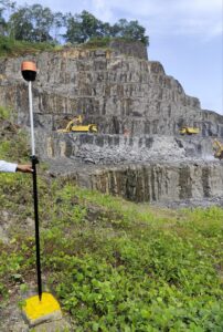
DGPS & Drone Surveys
At Wellmine LLP, our DGPS (Differential Global Positioning System) and Drone Surveying services deliver high-accuracy spatial data that transforms how you plan, monitor, and manage your mining projects. These advanced tools empower faster, safer, and more cost-effective decision-making.
For any inquiries call the
+91 9686551803